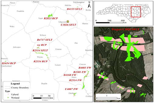
Geographical Information System (GIS) and Commercial Remote Sensing (CRS) technologies have become a critical and power tool in Wetland Management. Recognized nationally in recent 2011 FHWA Environmental Excellence Awards (EEA) for the Excellence in Environmental Research, NCDOT and NCDENR developed and integrated airborne LiDAR, digital imagery technology and statistical modeling for wetland measurement and inventory reporting. NCDOT has identified in [6] that “while NCDOT has made significant advances with the concept, the process and tools of predicting wetlands using LiDAR is under-developed. Additional research needs to be undertaken to improve the reliability and performance of the model across the various wetland types within the state.”
As such the definition of the NCDOT needs that will be addressed by the current project is to enhance the NCDOT wetland prediction procedure via procedure automation and further mathematical modeling. The procedure automation will be completed via mapping of domain knowledge. Since wetland classification is a highly heuristic process with strong reliance to the specific domain experiences, a critical challenge in procedure automation is the capturing of domain knowledge by the LiDAR data and through learning the decision making process of wetland experts. The ultimate goal of this project is to develop a set of tools that can simplify the NCDOT workflow via the development of a set of easy-to-use software tools and revised LiDAR-based wetland prediction models. The anticipated benefits to the NCDOT will be a high fidelity of selective wetland prediction with a significantly reduced process time. We will develop effective models, investigate statistical relationships among LiDAR data and wetland types, and generate the corresponding automation and GIS tools by working and consulting with the DOT and experts closely. In this project we will do the following research work:
- To review literature and to investigate the status of existing methods and models of LiDAR-based wetland prediction;
- To further develop models for specific wetland prediction based on LiDAR-integrated outcomes data from the NCDOT by statistical methods, data mining and pattern recognition techniques;
- To develop algorithms and tools for vivid visualization;
- To validate and improve the models via user and automatic control system feedbacks for correctness and automation;
- To investigate robust modeling analysis, anomaly adjustment and prediction for future robust analysis on model performance; and
- To prepare documentation for the proposed models, algorithms, and software tools.
It is also anticipated that the revised models will offer more useful information to the wetland prediction beyond current statistical models. The model and visualization tools can automatically and vividly display the types and regions by data, color or flash frequency, and is user-friendly based on the GIS platform (ArcGIS and ArcObjects) that NCDOT currently uses.

This project will enhance identification and prediction of wetland locations using LiDAR data, data mining, pattern recognition and GIS, thereby significantly reducing the time and cost of field delineations and providing early awareness of potential wetland impact areas during the initial project planning process, which can benefit NCDOT and EPA by innovative models and labor saving in the NEPA process.
