Bridges, pipelines, tunnels, highways, and roads require maintenance and regular inspections. Inspections provide safety, repair, performance condition, and status updates. Most inspections are manually performed by a trained professional with tools, a camera, and an activity sheet. North Carolina Department of Transportation (NCDOT) uses manned aircraft to capture images for airborne surveys but the process can be expensive ($2,000 per flight) and has its limitations like weather, cloud cover, sun angle, time, etc. The generally accepted cost for a manned aircraft imaging sensor is around $1,000,000 for a complete system. These flights are often a cost effective resource for large areas but not for small roads or bridges.
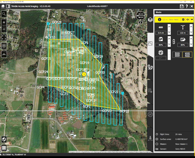
The NextGen Air Transportation Program (NGAT) at North Carolina State University (NCSU) collaborated with NCDOT (Location and Surveys, Photogrammetry, Aviation, etc.) to analyze the potential role of small Unmanned Aerial Systems (UAS) in transportation environments such as structural inspections, small area surveys, rockslide assessments, and other situations. This project has provided insight into UAS integration as an additional tool for situational assessment and surveying during inspection activities, especially for smaller areas and difficult to reach places. This Report summarizes the research and general analyses process used to evaluate potential UAS integration in the NCDOT inspector survey operations. The scope of this project evolved as regulations changed, opportunities were presented, and lessons were learned. The research team conducted over 100 flights capturing large amount of images and flight performance data to support the assessment objectives of the project.
This project started in August 2014 to provide NCDOT data to demonstrate UAS potential in a range of applications and evaluate integration strategies. The goals of the project included three primary objectives: capturing data, analyzing data, and making recommendations for routine integration. The NGAT and NCDOT flight teams captured quantitative and anecdotal data over the two years regarding aircraft performance, sensor performance, data accuracy, and UAS operational metrics. Despite numerous delays, authorization hurdles, a major flight incident, and some unplanned misfortune, the research team has collected and analyzed a large amount of data on this project and related projects to justify the recommendation for NCDOT to consider UAS operations to support specific types of projects. The research team was flexible and able to adapt to changing regulations while also taking advantage of strategic partners that are committed to UAS growth and maturation. This flexibility is evident in the report and data captured throughout this project.
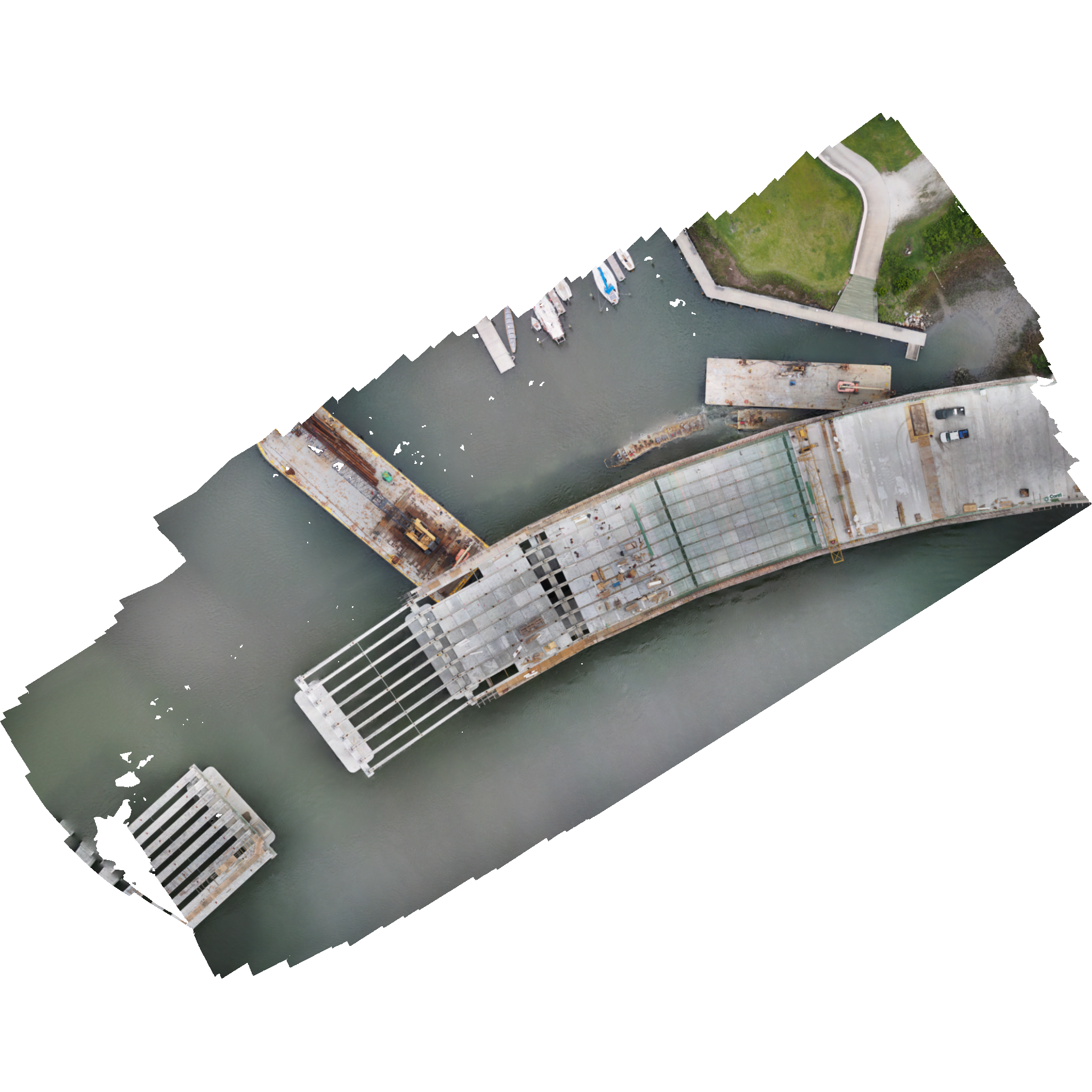
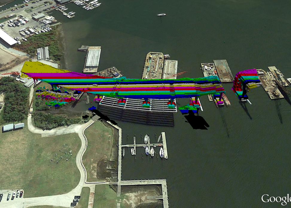
The summary conclusion from the data analysis is that small UAS are not a viable option yet for small area, high resolution surveys. Due to flight time limitations, varying confidence in system performance across a range of products, image limitations from nonmetric cameras, and data processing requirements, this project provided NCDOT a detailed assessment of current UAS capabilities. For highly accurate orthophotos, too many Ground Control Points were required for UAS data capture. The point cloud data sets developed in the image analysis processing produced such large numbers of points that computing requirements were challenged beyond traditional aerial image analysis. This experience and reference data were primary objectives of this project to assist NCDOT with future UAS integration planning.
Not all the UAS operations were considered nonviable for NCDOT however. The data sets captured for non-precise applications including traffic monitoring, structure analysis, and volumes were considered adequate for engineering use. These would be beneficial for accident reconstruction, workflow monitoring, and ramp metering. Video data sets and larger area orthophotos were provided as additional UAS products for consideration as part of this project.
UAS are just beginning to demonstrate efficiency and cost benefits in real world applications. The technologies will continue to evolve just as the regulations are changing. Based on the analysis of this project, NCDOT will benefit from UAS integration in specific applications and business units, but not all departments immediately. UAS expectations must be defined at the beginning to determine products, operational requirements (i.e. using internal resources or contract services), and feasibility.
