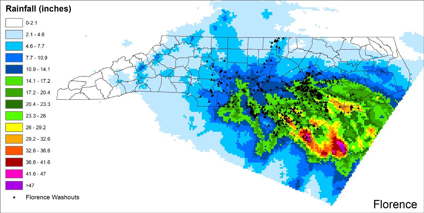
NCDOT provided data for 1410 locations where hydraulic structures (culverts & bridges) washed out during Hurricanes Matthew and Florence and during extreme flooding that occurred in 2020. Washouts were confirmed for 1313 locations. Drainage area, watershed characteristics and structure capacity and physical parameters were calculated and compiled for all washouts. The same data was also compiled for 3,610 structures that did not washout in a six-county area of the Coastal Plain that were located within a 1 km buffer radius of a washout. Statistical analysis revealed that rainfall intensities did not explain the differences between washout and non-washout locations. Washouts were found to be most common in small watersheds (<0.5 mi2), along secondary roads, on corrugated metal and reinforced concrete pipes with diameters < 72 in. In addition, lack of a headwall, shorter pipe lengths, high headwall over pipe diameter ratios and lower pipe area to watershed area ratios were common factors for many washout locations. A SAS Viya platform was developed in collaboration with the SAS Institute to allow for viewing, comparing, and exporting the data by proximity to a point, watershed or county boundary
Hydrologic and hydraulic modeling was conducted to identify and evaluate potential resilient routes for 3 study watersheds. HEC-HMS models were developed for two watersheds, Hunting and Drowning Creeks and a HEC-RAS rain-on-grid model was developed for Nahunta Swamp. The HEC-HMS models were used along with HEC-RAS to evaluate overtopping discharges at major crossings. I77 and US421 in Drowning Creek were identified as potential resilient routes and several river crossings in the Hunting Creek watershed were shown to have moderate to high resilience. However, the HEC-HMS and HEC-RAS approach to evaluate potential resilient routes was found to be limited because only ~15% of the washouts statewide occurred on FEMA mapped streams. For Nahunta Swamp, nine theoretical resilient routes were identified and evaluated using the HEC-RAS rain-on-grid model outputs. Modeled water levels for the 25, 50, 100 and 500-year storm were compared to the roadway elevation at all hydraulic structures and at every 50-foot segment of roadway along the nine resilient routes to determine depths of overtopping. Costing procedures for upgrading all structures and roadways above the flood level were developed. NCSU guided the SAS Institute in developing the Transportation Resilience Identification and Prioritization (TRIP) tool using the road, hydraulic and overtopping data as well as the costing procedures. The TRIP tool allows the user to 1) view and compile impacts of past storms and design storms, 2) prepare asset management summaries for existing roads and hydraulic structures, 3) evaluate the resilience of key transportation routes, and 3) estimate costs for increasing the resilience of existing routes to each design storm. In addition, NCSU developed a computer application to import radar rainfall data into HEC-RAS rain-on-grid models.
