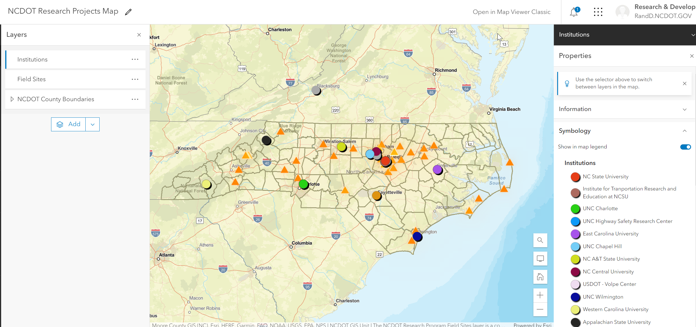
Since its inception, the NCDOT Research Project program, has supported more than 500 research projects. While information about each is accessible through the NCDOT Research Project database portal (https://connect.ncdot.gov/projects/research/Pages/ProjectSearch.aspx), these projects have not been mapped to display the spatial distribution of the recipients of the awards, along with a summary of the awards by organization and other relevant information. Interactive maps through a portal such as ArcGIS Online (http://www.arcgis.com) and Esri StoryMaps (https://storymaps.arcgis.com/) will provide a means by which NCDOT research projects can be mapped as point features. These real-world point locations can serve as links to additional information about the projects to include the PI(s), committee chairpersons and managers, year of project, project number, images and link to final reports.
These user-friendly and interactive mapping tools would complement the existing NCDOT Research Project database by providing another means to market, query and search this important NCDOT resource.

The NCDOT Research Program works with colleges, universities and other organizations to promote and fund research deemed important for NCDOT-related work. This work transcends the fields of engineering, environmental science, mapping, modeling, algorithm design, administration and management among other things.