The North Carolina Department of Transportation (NCDOT) needs a diverse set of cost-effective, reliable, and efficient tools to periodically map the bathymetry of various bodies of water across the state. Bathymetric data collection is used by NCDOT in several ways, including as input data for hydraulic modeling software (e.g., for floor risk assessment), to plan dredging operations, and to monitor scour around bridges. The long-term goal of this research is to improve the capability of NCDOT to efficiently and cost-effectively collect high-quality bathymetric survey data using unmanned surface vessel platforms in inland bodies of water. The specific research objectives are (1) experimentally evaluate a professional hydrographic survey unmanned surface vessel (USV) for NCDOT-relevant inland survey use cases, (2) transition USV survey capability to NCDOT, and (3) review USV/sonar technologies to envision and support current and future NCDOT needs.
This research project aimed to improve NCDOT’s capabilities in collecting high-quality bathymetric survey data using unmanned surface vessels (USVs), focusing on evaluating current technologies, supporting their adoption by NCDOT, and tailoring tools and workflows to NCDOT’s specific use cases. A comprehensive literature review was conducted to assess the state-of-the-art in USV technology. This review explored the history and regulation of USVs, their integration with sonar systems and how similar technologies have been used by other state transportation departments.
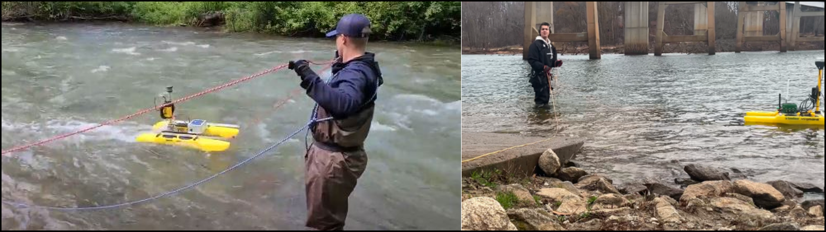
A detailed database of 91 commercially available USVs with bathymetric capabilities was created, and the vessels were compared based on criteria such as weight class, country of origin, hull design, speed, endurance, and sensor configurations. Standard parameters for sonar systems, GNSS sensors, and communications technology were also outlined. Eleven potential NCDOT use cases were identified, and each was matched with suitable USV criteria. A commercial hydrographic survey USV—the HyDrone from Seafloor Systems—was also purchased and used to gain hands-on experience with its deployment, operation, and maintenance. Several enhancements were made to the USV, including the integration of a third-party RTK GNSS receiver, a connection to the North Carolina CORS network, and the addition of a first-person-view (FPV) camera system. The FPV system significantly improved the operator’s ability to safely navigate around structures and debris, especially in situations where traditional remote control or pre-programmed missions would be limited. A detailed workflow was developed for planning and executing survey routes using HYPACK software and for processing the collected bathymetric data in ArcGIS to produce depth contour maps and triangulated irregular network (TIN) models.
Over the course of the project, the HyDrone was deployed 25 times across 10 unique sites, resulting in 41 hours of total in-water survey time. These tests demonstrated the ability to collect and visualize bathymetric data in the field for rapid assessment, and they generated datasets that provide insights into key operational parameters. These include battery consumption rates, the impact of GNSS signal quality with distance from structures, vehicle maneuverability, and overall setup and deployment logistics. The team recommended a deployment workflow. In addition, a specialized coverage-path planning (CPP) algorithm was developed to optimize USV missions in shallow water environments. The algorithm incorporates prior bathymetric knowledge and a statistical model of the vehicle’s path-following performance to reduce the risk of collisions. It outputs a set of optimized waypoints that maximize area coverage while maintaining a predefined safety margin.